Ma Time (Las Vegas, NV)

It’s been a busy few days since my last post.  I’ll try to get caught up here.

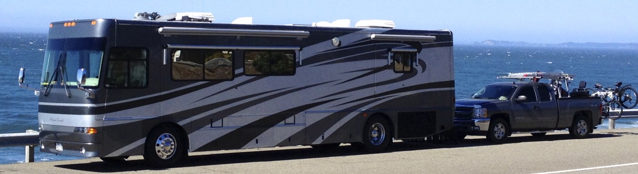
We found a (somewhat) quiet corner of the truck stop in Barstow for Thursday evening as I mentioned in my last blog post.  Here’s a picture I took Friday morning before we headed on up I-15 to Las Vegas.

IMG_4370

About 150 miles later we passed the Welcome to Nevada sign:

IMG_4387

We found a RV park by using the “Points of Interest” option on the Rand McNally GPS.  Of course, I researched it quickly on the internet to validate it’s authenticity.  It was a very reasonable $20 per night.

We ended up at the Main Street Station Casino, Brewery, Hotel & RV Park near the famous (or infamous) Fremont Street.  That’s on the North side of Las Vegas.  I called ahead to confirm a spot and they assigned me to site 200… and what are the odds – we were parked right next to another Alpine Coach!  With only ~1,400 Coaches ever built between the years 1999 and 2009, that’s a somewhat rare occurrence.  Unfortunately, we never got to meet the owners in the two days we were there.  They were always seemed to be out and about at the times we were in the park.

IMG_4464

It wasn’t long after we arrived that we were met by my brother Steve, his long-time girlfriend Cheryl along with my Mom and Stepdad in their chauffeured Escalade.  They have a time-share of sorts with Wyndham Resorts which is where they were staying.  The limousine service is courtesy of the resort.

IMG_4465

They took us to Caesars Palace to enjoy the Bacchanal Buffet.

IMG_4404

IMG_4417

The food was excellent albeit rather expensive.  All the dishes are prepared by Chef’s.  Here’s a link to learn more if interested: http://www.caesarspalace.com/restaurants/bacchanal-buffet.html#.VCorPUtGGQc

 And then we  supported the local economy by playing the slots.

IMG_4425

Here’s an indication of how our evening went… notice that the “7’s” aren’t on the payline 🙁

IMG_2148

Here’s my beautiful Ma and wonderful stepdad!  Love ya mom & Jimmy.

IMG_4430

Obligatory picture of one of the Las Vegas signs.

IMG_2144

We spent the rest of the evening touring the Fremont Street Experience.  For those of you that have never been, here’s a link: http://vegasexperience.com

The light show is pretty cool.

IMG_4491

IMG_4488

IMG_4487

And there were lots of characters walking the street… many of whom I couldn’t post to this blog in order to maintain something less than an “R” rating.

IMG_4483

IMG_4479

IMG_2122

IMG_2127

IMG_2123

This is the zip-line that runs above the street.  You can see some people getting ready to go in the second picture below.

IMG_2136

IMG_4501

These folks got stuck and had to be rescued.
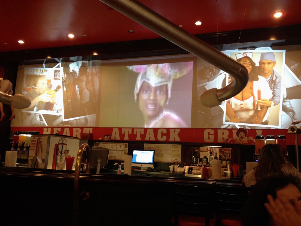
IMG_2153

We ended up at the Heart Attack Grillhttp://www.heartattackgrill.com for a late night “light” snack 🙂

IMG_4495

IMG_4494

IMG_4499

On Saturday morning, we said goodbye to my Mom, Stepdad, Steve & Cheryl after a hearty breakfast at the Plaza Hotel’s Hash-a-go-go http://www.plazahotelcasino.com/dining/hash_house_a_go_go  They have to get back home to Las Cruces to go on diets 🙂

After breakfast and goodbye hugs… Stilla and I then spent the rest of our Saturday checking out a few local tourist attractions… the first was one of my favorite’s, the site of American Restoration.

IMG_4512

IMG_4526

IMG_4517

IMG_4536

The free guided tour through the shop was really neat, but they don’t allow photos inside because customers haven’t seen their finished restoration projects yet.

IMG_4532

IMG_4533

I pulled the truck up front for a photo-op.  Rick didn’t come out to offer to restore the Harley for me 🙁

I did get the T-Shirt at the gift shop though.

IMG_4539

Next, we went by the site of Pawn Stars.  I honestly have only seen a few episodes… not one of my favorites, but it was cool to see.

IMG_4549

IMG_4542

IMG_4544

IMG_4546

This Elvis painting was for sale at some outrageous price.

IMG_4548

We must have arrived at just the right time… there was quite a long line forming as we exited.  Must be a popular site, or a tour bus might have shown up.

IMG_4551

Then I tracked down where Counting Cars is filmed at Counts Kustoms http://www.countskustoms.com was located and we headed over there.  I bought the T-Shirt.

IMG_4554

IMG_4560

IMG_4567

IMG_4555

IMG_4573

IMG_4580

Stilla and I visited Fremont Street again to close out the evening and took in some of the street band music that plays in a few different spots along the covered street.

On Sunday, we hit the road again for Saint George Utah.

We continued on I-15 and went through the corner of Arizona after leaving Nevada.

IMG_4590

It had clearly rained the day prior as evidenced by the very soggy desert.

IMG_4582

IMG_4583

Interstate 15 passes through a pretty cool canyon at one point.

IMG_4612

IMG_4613

IMG_4624

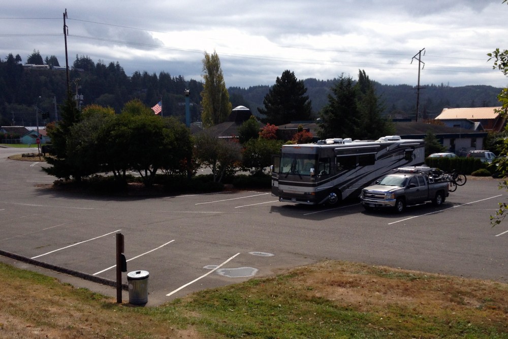
And here’s the Saint George, UT Elk’s Lodge 1473.  Now this has to be the most scenic Lodge we’ve stayed at to date.  Travel distance for the day was around 120 miles.

IMG_4633

We pretty much had the RV Park portion of the parking lot to ourselves.  Only two or three other rigs there.  We heard that we just missed a busy weekend, the lot was full this morning.

IMG_4636

Here’s a couple pics of the lodge.

IMG_4638

IMG_4641

IMG_4643

IMG_4644

The view from their deck.

IMG_2160

IMG_2159

And this was our spot below the cliffs.  It’s only $15.  Electric hook-up only.  Wish we could stay here longer, but son William is due in from Germany on the 5th of October, so we have to be back in Colorado Springs.  Also, we have a small problem with the rent – we haven’t gotten any for the last month or so…

IMG_2163

Til next time… stay tuned.

Bro Time (Westley, CA)

It’s been a couple days since my last post.  We’ve been busy hanging out at my brother Ron’s house in Westley, CA.  Let me bring you up to date:

We arrived early Tuesday evening after our long day’s drive down I-5  and through Sacramento.  After hugs and a tour of the house and adjoining machine shop, we made a trip to the local WalMart to replenish the fridge and more importantly – get some steaks for the BBQ grill.     We spent time grilling and catching up.  It was great seeing them again, it’s been a long time… years in fact.

We parked on the street beside their house during our stay.  Ron graciously provided a power outlet so we could run one of the air conditioners or the microwave without having to start our generator.

IMG_4319

Wednesday ended up being a full work day in the fully-appointed machine shop next to the house.  I conned (I mean, talked) Ron into doing some modifications to the Silverado’s bed-rails and motorcycle ramp.  Nephew James stayed home from work and helped out as well.  Ron figured out how to slice a long piece of aluminum off the bed rails so I can better secure my tonneau cover when I’m not carrying the Harley.  He also invented a quick-release mount for the motorcycle ramp to secure it on top of the rack.  Now I don’t have to struggle with a bunch of bungee-cords every time I transport the ramp.

Here we put everything back on the Silverado after having to disassemble the truck rack to make the modifications.

IMG_4326

The tonneau cover now rolls shut and and fits tightly between the bed rails.  Thanks Bro!

IMG_4325

Ron even took the time to modify the pivot bar that holds the three-piece motorcycle ramp together… the bar was too long and the hole for the pin allowed for too much movement between the individual pieces, so he cut it shorter and re-drilled a new hole for the pin.  Now it’s much safer to use, and there’s no chance for a foot or even worse – a motorcycle tire to accidentally slip between the pieces.

IMG_4328

I forgot to take a picture of the quick-release mount that Ron invented to secure the ramp on top of the rack during transport.  But here’s some pics of Ron in action:

IMG_4324

IMG_4330

We closed out the evening with another great BBQ meal in the back yard.

It rained Thursday morning… just enough to make us not want to get packed up and move.  But, we need to move on down the road and get back to Colorado Springs before our son William comes to visit us in October.  So we slowly got packed up by noon, said our goodbyes’s  and thanked Ron & Terry for everything.  It was about 1 PM by the time we hit I-5 headed South.

Hopefully, I get to see my brother again on Thanksgiving… he’s planning on being in Arizona, as do we.

The roads between the many orchards in the area were muddy from the rain.  Lots of vehicles coming onto the roadway from the orchards had made a mess of the pavement.  Looks like I get to give the Urban Escape Vehicle and pickup a serious washing now.

The sun came out and it dried up quickly.  It wasn’t long before we had to turn on the dash AC again.

We started going through our routine of finding a campground or RV park while traveling down the road since we had good cell signal on I-5.  It looked like the Elks Lodge in Barstow would be a good destination for the day.  The website said it had 77 RV spots in the Lodge parking lot.  So I plugged it into the GPS and we decided to make it a long travel day.  Also, we still needed to decide what route to take back to Colorado, and Barstow happens to be located at the point where we can either choose to go North on I-15 through Las Vegas and then on to I-70, then I-25 at Denver to get to COS; or –  we can catch I-40 East at Barstow which will take us through Flagstaff and Albuquerque to get on I-25 to COS.

It so happens that my Mom, Stepdad, and other brother Steven along with his better-half Cheryl, are currently in Las Vegas on vacation.  So I contacted them to be sure they are still there (they will be until Saturday) so that cinches it – we now have our next destination… Las Vegas, here we come!

IMG_4355

Typical highway scenery after we got close to Bakersfield.

IMG_4369

It was 7 PM when we finally rolled into Barstow looking for the Elks Lodge.  We found it, but it was closed!  We wondered why the Elks.org website didn’t show info on the Lodge but we did find all kinds of info and reviews on google.  The place looked like it was being sold.   Anyway, we chalked that up to another lesson learned… don’t trust google without verifying!

So we did a quick search for other overnight options and found a Flying J truck stop 4 miles further down on I-15.  Good enough for the night since it’s late anyway.  And besides, we now want to hurry up and get to Las Vegas tomorrow so we can get as much time as possible in with my Mom/Stepdad & other brother Steven and his better-half Cheryl before they go back to Phoenix and/or Las Cruces on Saturday!

We did 335 miles today… whew!  I don’t want to do that too often.

Signing out from the truck stop… C U tomorrow!

Avenue of Giants & Moving Day (Westley, CA)

We did it!  We completed the entire Hwy 101 “Pacific Coast Highway” although as I type this, I remembered that the signs started calling it the “Redwood Highway” once we dipped into California.

Our Hwy 101 adventure started in Olympia WA, where we went North to Port Angeles, and then headed South along the entire Washington/Oregon coastline – all the way to Leggett CA where you have to either choose to turn on Hwy 1 (which continues along the CA coast) or stay on 101 which starts inland.  We chose to continue on 101 inland so we could jump over to I-5 via State Highway 20.

We had decided to head down to Westley, CA to visit my brother Ronald.  Westley is located about 80 miles South of Sacramento.

So to catch you up on our continuing adventure – we left the Chinook RV Resort in Klamath CA on Monday at a leisurely 11 AM.  Our goal for the day was to take the “Avenue of Giants” because you just can’t get enough of these magnificent redwoods.

But first, we caught our last few views of the Pacific Ocean.

IMG_4107

IMG_4109

IMG_4111

IMG_4113

IMG_4115

After driving through the town of Eureka we finally got to the turnoff for the Avenue of the Giants which is a 31 mile scenic byway that parallels Hwy 101.  It was awesome – but again, pictures just don’t do it justice.  Here’s a link to my friend Wikipedia for more information on the route:  http://en.wikipedia.org/wiki/Avenue_of_the_Giants

IMG_4120

IMG_4122

We pulled off to the side at the first opportunity to view some of the trees first-hand.

IMG_4126

IMG_4150

Here you can see that the leaves are already changing colors… more evidence that it’s time to keep heading South 🙂

IMG_4175

IMG_4179

After our scenic (but somewhat slow-paced) excursion through the Avenue of Giants, we got back on Hwy 101 proper and noticed that the scenery was changing dramatically… it was definitely drier here.

IMG_4182

IMG_4183

We turned East on 20 to get over to 1-5 but it was getting late (about 5 PM) so we started consulting our resources to find a spot to spend the night.  Our Passport America app turned us on to Kelly’s Family Kampground near the town of Upper Lake which is on the North side of Clear Lake.

After turning off the highway for about 2 miles to get to the campground, our Rand McNally GPS guided us in.  What a beautiful campground… and we had it all to ourselves with the exception of the owner who bicycled from her house at the entrance road to greet us.  We decided to boondock for the night because the sites were heavily wooded with no line-of-site for the satellite.   Also,  it just looked so peaceful by the pond – so that’s where we decided to lower the jacks.

IMG_4250

IMG_4237

This is the road into the campground.  The owner – I think she said her name was Patti Kelly, only charged us $12 for the night.  Our travel distance for the day was about 230 miles.  The only bad thing about the campground was no signal on the iPhones with AT&T and only one bar on the MiFi JetPack with Verizon which also equated to no signal because we couldn’t get any emails or websites to upload.  But we had satellite, which was nice after sitting by the pond in our folding chairs to watch the evening local wildlife and stars.

IMG_4242

The camp store and office – all but closed for the season.

IMG_4200

Our boondock spot next to the pond.

IMG_4234

IMG_4197

That’s the Urban Escape Vehicle on the other side of the pond.

IMG_4257

Our view out the front window.

IMG_4264

IMG_4241

There were wild turkeys everywhere.

IMG_4227

IMG_4212

Little Coach didn’t know what to make of the turkeys… he didn’t know whether to chase them or be scared.

IMG_4217

In the morning (Tuesday) I did a PMCS, that’s Preventive Maintenance Checks and Services for you non-Army types, and found that one of the baseplate connections on the truck seemed loose.  It moved up and down and it shouldn’t do that!  This is the towbar connection point on the truck that is permanently mounted to the frame on each side.  I inspected further, and found that the bolts were slightly loose, the bolt head was gouging into the frame as you can see from the picture below.  There should be a flat washer  there.  I didn’t have any large flat washers on hand in my stash, just smaller diameter ones, so I tightened the bolts (on both sides) as best I could and made a commitment to stop at the earliest opportunity and get new washers.

IMG_4105

So after just a few miles, we found a NAPA store in the town of Upper Lake with a big parking lot.  I broke out the tools and took the bolt out to go inside for the right sized flat washers and also new split-washers for the “nut” side of the bolt.

IMG_4274

Good thing I had everything needed.  It pays to be prepared.  I had to use the cordless drill driver to grind down the edges where the bolt head had gouged the frame and then I used my red loc-tite to put everything back together.

I only did the one bolt because it was so difficult to get the lock-nut off in the limited space available, and the other bolt looked fine at this time.  I figured that once I get to my brother Ronald’s house, I could tackle the other one.  I purchased extra washers to keep on hand.

IMG_4275

Here’s a picture of the “wallowed out” hole in the frame caused by the bolt head not having a flat-washer underneath it to spread out the clamping force.  There’s a lot of weight and pressure put on these two bolts when we are pulling the truck around corners and over some of the “fine” roads we have traveled recently.

IMG_4273

With my confidence at a much higher level about the safety and security of the truck and Harley behind us, we continued our travel along State Highway 20.

IMG_4277

Very dry with evidence of recent forest fire here.

IMG_4293

IMG_4299

Once we got to I-5 and started heading South, we stopped at a Pilot/Flying J to fuel up.  80 gallons at $4 per gallon 🙁

We continued through Sacramento – man do they ever need to fix these roads!  And the traffic was terrible… Lots of folks passing and weaving – in a hurry to get to who knows where – and lots of trucks too.  There were uncovered gravel trucks, open loads of tomato trucks, and even an uncovered hay truck, which reminds me – I need to check the intake to the air filter to clean some of that out!

IMG_4303

After 196 miles today (Tuesday) we ended up at our current destination: Westley CA, home of my brother Ronald and his wife Terry.  Here’s a few pics of the route into their little town – don’t blink, you’ll miss it if you go too fast 🙂

IMG_4307

IMG_4309

IMG_4310

Preview of the evening’s agenda.

IMG_4314

Stay tuned…

Trees of Mystery & More… (Klamath, CA)

It was 2 PM on Sunday before we got away from the park today.  We changed sites 3 more times before we solved our power problem that I described in yesterday’s post.

The camp host was very accommodating and moved me to another site, but it was just another 30 amp pedestal and I had the same problem as before.  The Surge-Guard display toggled between “No Ground” and “Check Wiring” and wouldn’t stay connected to shore power.  So the camp host found me another site but I had to wait for the current occupant to leave.  It was also a 30 amp site and once I was able to pull in and plug in, I still had the same problem.  At least this time, I didn’t put the jacks down or the slides out before I plugged in.

The camp host kept checking on me throughout the morning, as did several other overly-enthusiastic camp occupants… Nice folks here.  I had just resigned myself to “boondocking it” for the rest of today and tonight (I even warned my neighbor about running my generator) when finally – a 50 amp site opened up unexpectedly, and the camp host moved me in.  Everything worked fine on the 50 amp in site #1 🙂  I was really starting to worry that my problem was with the Coach and not the park power.  Although, I’ve never had problems on 30 amp power before, that is – other than tripping the breaker because we forgot to turn off the coffee pot while we still had an AC running or the microwave.

It turns out that most of the tenants here at the Chinook RV Resort are long-term residents that stay for the entire summer fishing season or longer, and most have travel trailers or 5th wheels that are fine on 30 amp power.  All the other big rigs (Motorhomes) here are parked at the limited number of 50 amp spaces.  Of course, I won’t know for sure until I get to the next campground and I plug into 30 amp again, but I’m going to assume for now that my Surge-Guard was simply doing it’s job, and the park’s 30 amp wiring here needs an upgrade.  All the pedestals and boxes here are pretty old and deteriorated.  The first one I plugged into almost fell over, the wooden pole was so rotten.

With the power problem solved for now, Stilla put some more clothes in the washer/dryer combo while I got tips from the camp host and others on local sites to see.  We left at 2 PM with a list of things to go see and do today, so follow along and enjoy the pics.

Our first tip was the Klamath River Overlook on Requa Road which is a loop that climbs the mountain, (hill), that overlooks the mouth of the Klamath River at 600 feet.  It was only 1/2 mile from our campground.  Here are the views.

IMG_3945

IMG_3941

IMG_3943

IMG_3944

We still didn’t see any whales 🙁

Our next tip, which is a place we had passed on the way into town the day before – and knew of already, was the Trees of Mystery and Sky Trail (Gondola) Ride.  This was one cool place that has a lot of history.  It was founded in the early ’30s right off Hwy 101 and is only 3.5 miles North of our campground.  Many of the trees here have been seen in Ripleys Believe  It or Not.  I’m sure this is one of the most visited and photographed sites in Northern California.

Here’s a link to their website if you would like more information. http://www.treesofmystery.net  Enjoy the pics… although, as usual – the pictures don’t do the place justice.

IMG_3946

IMG_3949

The entrance fee was $15 per person.  Now this was definitely high on my personal value-meter.  Well worth it!

IMG_3950

IMG_3951

IMG_3954

IMG_3955

IMG_3958

IMG_3961

IMG_3963

IMG_3969

IMG_3967

IMG_3971

IMG_3972

IMG_3984

We passed some folks on one of the trails that were fascinated with something on the ground and were taking pictures… it turns out this is a rarely seen banana slug that was crossing the trail.  So, I followed suit and took a picture also.  So enjoy.

IMG_3992

IMG_3982

IMG_2048

IMG_2045

IMG_2062

IMG_3979

IMG_3985

IMG_3991

Once again, I don’t know how Stilla does it, but she found some more Germans.  There was a film crew from Germany climbing one of the trees.  They were doing a documentary on the Redwoods.  We watched them for a while, at one point they even put a camera drone up in the air to film the climbers.

IMG_3993

IMG_2053

We continued on with our tour after the climbers were out of sight.

IMG_4030

IMG_4029

IMG_4039

IMG_4038

IMG_4034

IMG_4049

IMG_4043

IMG_4047

IMG_4050

IMG_4051

IMG_4052

A highlight of this Place of Wonder is the Sky Trail (Gondola).  It was included in the entrance fee.  We had a six-passenger gondola all to ourselves.  It takes 8 – 10 minutes to make the 1570 ft trip up the mountain.

Here is the entrance at the bottom.

IMG_3995

IMG_3996


Going up…

IMG_4004


and up…

IMG_4008

Our obligatory selfie:

IMG_2056

IMG_4009

IMG_2057

Here we are at the top.

IMG_4011

IMG_4012

IMG_4013

IMG_4016

IMG_4018

Here you can see the Pacific Ocean in the background.

IMG_4019

After our fantastic trip above the trees, we drove back to the Coach to get little Coach so we could go through a tree.  Unfortunately, we had left him in the Coach because we assumed the Trees of Mystery park wouldn’t be dog-friendly – the opposite was true, they allow dogs on leashes  everywhere in the park, even the gondolas!  But it was too late for little Coach to make his mark on any of the greater than 2,000 year old trees.  So anyway, we picked him up and continued 1.5 miles the other direction (South) from our RV site to the next tip we got from folks at the campground – The Tour-Thru Tree!

IMG_4068

I had to pull the mirrors in, but we fit.  Here’s a picture I took in the mirror after we passed through and I pushed the drivers-side mirror back out.

IMG_4066

IMG_4071

IMG_4072

When I said we fit – it was with one caveat.. I had to loosen one of the bicycles on the rack because the tire was starting to rub on one side.  But hey, we fit 🙂

IMG_4073

That was worth the $5 entrance fee.  The tree is approximately 785 years old and the opening is 7’4″ (2.23 m) wide and 9’6″ (2.90 m) high.

The next tip we got from the camp host was to take the Newton B. Drury Scenic Parkway which is a road that parallels Hwy 101 and goes through some more of the fantastically huge Coastal Redwoods.

But first we had to cross the Klamath River bridge.

IMG_4077

This is the Klamath River.

IMG_4082

After driving through some more of the scenic forest along the Newton B. Drury Parkway  (which used to be part of the original Redwood Highway) to the Prairie Creek Redwoods State Park we arrived at Elk Prairie and the Ranger Station.  It closed at 5 PM and it was now 5:30, so we just toured the outside of the building, took pictures of Elk in and around the meadow there, and took a short walk in the woods to close out our evening.

IMG_4083

IMG_4084

IMG_2069

IMG_2072

IMG_4085

IMG_4086

This picture of the map on the ranger station wall shows our location.  Sorry about the quality, but as always, if you click on any of the pictures you get an enlarged view.

IMG_4091

We took the long way back along a rarely used coastal road.

IMG_4092

IMG_4093

For those interested in WWII trivia; we came upon a “farmhouse” that was really a radar station in disguise.  It has been preserved here on the coast just south of the town of Klamath.  The placard below provides some interesting information.

IMG_4095

Here’s the roof of one of the disguised radar stations from WWII.

IMG_4094

We finally got back to our campground just after dusk.  Shore power was still working fine and we even have satellite TV through the rooftop dish at our latest spot.  I worked on this blog post while we watched some TV.  We’ll head on a little farther South tomorrow (Monday) before we start moving back East towards Colorado… at least that’s the plan for now 🙂

IMG_4098
Site #1 at the Chinook RV Resort, Klamath, CA.

Redwoods – Jedediah Smith State Park (Klamath, CA)

We got a somewhat late start on this lazy foggy Saturday morning.  We didn’t leave the Elks Lodge in Brookings, OR until almost noon.

If it seems like we are moving along from place to place at a fast pace – it’s because we are.  We want to be back in Colorado by October because our son William is coming in from Germany for a three week visit with his girlfriend.  He intends to use our house in Colorado Springs as a jumping off point to visit the area.

Anyway, just South of town we crossed into sunny California – only it wasn’t very sunny today.

IMG_3867

About 25 miles later, as we got close to Crescent City we spotted the signs for the Redwood National and State Forest Visitor Center, so we pulled into an empty lot out front and went inside for information on the Redwood Forests.  We’ve never been here before and wanted to get the scoop on what is where – and more importantly, where we can go in the big rig.

IMG_3869

The park rangers inside were very helpful and gave us a tip about the Jedediah Smith Redwoods which is part of the Del Norte Coast Redwoods State Park.  They told us about a nice drive on Howland Hill Road just outside of town here with a highly recommended “must-see” hike through the Stout Memorial Grove.  And they were right – it was truly awe-inspiring!  The intended destination was definitely not big-rig friendly, so we unhooked the truck and left the Urban Escape Vehicle in the parking lot behind the building.

IMG_3872

Once on Howland Hill Road, the pavement quickly turned to dirt and it got very narrow.  I kept wondering why they didn’t make this a one-way road through here, because we had to back up or pull off on the side more than a few times to let others pass, and vice versa.

IMG_3873

Wow… these redwoods are awesome!  They don’t grow trees like this in Colorado.

IMG_3877

IMG_3883

IMG_3886

At one point, out in the middle of the forest, we met up with some other RV’ers from Colorado that we recognized from our stay at an Elks Lodge in Kelso/Longview some weeks ago.  Small RV world 🙂  They told us they were staying in Klamath at the Chinook RV Resort, and recommended it to us for tonight’s destination.  We thanked them and since we (surprisingly) had a cell-phone signal, I called and made a reservation for us to arrive later today.  With that out of the way, we parted ways and continued our scenic drive.

IMG_3888

IMG_3890

Here are the pictures of our hike at Stout Grove.  All I can say is WOW!  The pictures don’t do justice to the magnificence of these redwoods.

IMG_3892

IMG_3893

IMG_3894

IMG_3895

IMG_3897

IMG_3900

IMG_3901

IMG_3905

IMG_3907

IMG_3913

IMG_3918

IMG_3920

After our tour of the redwoods here near Crescent City, we hooked the truck back up to the Coach and headed on South to Klamath.  We felt lucky that we had a little sun while we were in the woods because the fog seemed to roll in just as we hit the Pacific Coast Highway again.

IMG_3923

IMG_3924

IMG_3925

IMG_3928

IMG_3931

We arrived at our destination and decided to stay for two nights.  Since this is a Passport America park, we only had to pay $15 per night.  The camp host directed us to a 30amp hook-up spot next to the river, which we found out later wasn’t such a good thing… Stilla put a load of clothes into our Splendide washer/dryer combo and the motorhome’s Surge-Guard kept cycling on and off.  The display for the Surge-Guard flashed the warning “Open Ground” and “Check Wiring” a few times, but it never popped the circuit breaker, it just kept switching power from the park pedestal to our inverter… back and forth.  Since it was late and the office was closed, we just unplugged and ran the generator to finish our load of clothes.  Once our clothes were done, I tried plugging into park power again and it kept doing the same thing, even when I had everything turned off , and I mean everything: no TV; no surround sound; no Direct-TV; no AC or heater; no Keurig coffee maker; nothing plugged into any outlets; etc.,  The only items drawing power would be the inverter/charger itself and the residential refrigerator, and I have to leave those on.  So I unplugged again and we just boondocked for the night.  I figured we would deal with it in the morning.  More to follow on this.

Meanwhile, here are some pics of our current location.

IMG_3934

IMG_3932

IMG_3937

IMG_3936

IMG_3938

IMG_3939

We only went 45 miles today from Brookings to Klamath, but there is just so much to see here – so stay tuned!

Lighthouse Celebrities & Sunsets (Brookings, OR)

We started our Friday beach tour before 10 AM.  We weren’t sure where we would end up at the end of the day, but we had another Elks Lodge in mind.  We continued our route down the PCH (Pacific Coast Highway) through the picturesque town of Bandon.

IMG_3666

IMG_3667

We of course stopped at most of the pull-offs to enjoy the views.  The weather was nice again, but a little windy.

IMG_3670

IMG_3672

IMG_3673

IMG_3674

We wanted to stop at Oregon’s westernmost lighthouse, so just South of the small town of Sixes, we turned West.

This is the road to the Cape Blanco Lighthouse.  The lighthouse is a 5 mile side trip off the PCH.

IMG_3676

Notice below how I utilized my keen photographic skills and managed to capture the lighthouse inside the hole at the top of this sign 🙂

IMG_3681

We were able to park the Urban Escape Vehicle in the large turn-around parking area located a little ways from the lighthouse.

IMG_3682

It was a decent hike from the parking area to the lighthouse as you can see from this photo with Stilla in the foreground.

IMG_3684

When we arrived at the gift shop/greeting area that is separate from the lighthouse, I immediately recognized Chris & Cherie from their full-timing RV blog, “Technomadia”.  I have followed their blog for quite a while and especially enjoy their tips for staying connected on the road.  They are volunteer hosts here at the lighthouse.  And guess what – I found out that another couple is also volunteer hosting here at the same time – Paul & Nina from “Wheelingit”.  I also follow their blog, they were up at the lighthouse whereas Chris & Cherie were down at the gift shop doing the meeting & greeting.  Here I posed with Chris & Cherie in front of the lighthouse.  It was neat to finally meet them in person after reading their blog all this time.. it’s like meeting celebrities!

IMG_3689

Here is Chris & Cherie (above). Their website is: http://www.technomadia.com/2014/09/new-views-on-cape-blanco/Windy….  Check it out!

Dogs aren’t allowed in the lighthouse, so Stilla walked Coach around the grounds while I went up for the lighthouse tour.

IMG_3690

This is the light at the top of the lighthouse.  Cool pic eh?

IMG_3698

I zoomed in on the Urban Escape Vehicle back at the parking area.  Good to see it was still there.

IMG_3702

Here’s Paul from “Wheelingit” explaining the inner workings of the lighthouse at the top.

IMG_3706

And this is Nina from “Wheelingit” giving the tour in the downstairs area of the lighthouse.

IMG_3708

Nina graciously posed with me for a pic.  Must be nice to be a celebrity 🙂

IMG_3709

Paul & Nina’s website is: http://www.wheelingit.us

Another view of the Cape Blanco Lighthouse which was built in 1870.

IMG_3711
Cape Blanco Lighthouse.

Here’s a view of where we are on the Rand-McNally.

IMG_3719

We snacked in the Coach before we continued on down Hwy 101.  It was nice to get out of the wind here.  Then we motored on.

Here are some views down around the town of Port Orford.

IMG_3731

IMG_3736

IMG_3737

IMG_3739

Sometimes little Coach doesn’t want to get out of the Coach, he’d rather just watch us silly humans take pictures.

IMG_3742

Sometimes there weren’t any pull-offs for pictures, so I just took pics from the cockpit.

IMG_3745

IMG_3748

IMG_3753

Near the town of Gold Beach we pulled into the parking area for the Prehistoric Gardens.

IMG_3754

Have you ever had this view outside your window?

IMG_3755

IMG_3758

They wanted too much for admission.  $12 per person just didn’t register on my value-meter, so we passed.  Coach was more interested in the chipmunks and bluejays anyway..

IMG_3763

IMG_3765

IMG_3768

I took advantage of a photo-op along a wide pull-off just North of Gold Beach to get a possible new Cover Photo for the blog or maybe Facebook.

IMG_3777

Another historical bridge leading into Gold Beach.

IMG_3782

IMG_3785

IMG_3787

More over-the-road pics:

IMG_3793

IMG_3801

This was a nice rest area with a hiking trail – Arch Rock.

IMG_3804

Located here:

IMG_3805

IMG_3806

IMG_3810

IMG_3811

IMG_3820

IMG_3823

A couple artists were using watercolors to capture the view.

IMG_3824

IMG_3826

Then, we drove over the highest bridge in Oregon – at least, that’s what the sign says.

IMG_3829

We ended up at the Elks Lodge in Brookings, OR.  Total distance traveled for the day was a little less that 90 miles.  The Lodge RV Park, located in their parking lot, had full hook-ups with the exception of sewer.  A dump station is on site.  They had a suggested donation of $18 per night, and it was Friday which at most Lodges we’ve visited, means they serve dinner.  Tonights menu included Fish & Chips or Hamburgers.  Stilla had the fish and I had a cheeseburger that was undercooked.  It must have been a bad day for the waitress, I think she quit while we were there.  (Hopefully not because of my undercooked burger).  Stilla played a little on the slots.  I forgot to take pictures of our RV site and the lodge.

IMG_3832

After our dinner, we drove around town and checked out the harbor and then decided to drive a couple miles South of town to a nice beach where we could  enjoy the sunset.  The beach happened to be just across the California border.  So here’s the sunset from sunny California… it looked the same to me as the one in Oregon.  What do you think?

IMG_3834

IMG_3838

IMG_3840

IMG_3841

IMG_3842

IMG_3846

IMG_3858

Tune in tomorrow to see where we are…


Lighthouses, Dunes, and RV Park Poles (Bullard State Park, OR)

We left the Three Rivers Casino RV parking lot by 10 AM on Thursday.  It rained off and on all night.  It was still overcast and a little foggy in the morning, but by the time we made our first stop in Reedsport, the sun was out again.

We wanted to check out the sand dunes that  I had read and heard so much about.  All the tourist guidebooks and pamphlets we picked up along  our Hwy 101 travels, mention this “must-see” area when visiting the Oregon coast.  Here’s my friend Wikipedia’s scoop on the place: http://en.wikipedia.org/wiki/Oregon_Dunes_National_Recreation_Area

The only problem with visiting the 40 miles of dunes, is figuring out which areas I can get into – and more importantly, back out of – with a 38 1/2 ft Motorhome pulling a Silverado.  So, my solution was to stop at the Oregon Dunes Visitor Center in Reedsport, OR.  The nice power ranger, er, I mean park ranger behind the counter gave us maps and info flyers but she was unsure which access roads were big-rig friendly.  So to be safe, I asked her if we could leave our motorhome in the parking lot while we unhooked our truck and drove on to check it out.  She said no problem.  Here’s a picture of the Visitor Center parking lot where we left the Urban Escape Vehicle for awhile.

IMG_3551

Here are the informational placards in front of the Visitor Center for your viewing pleasure:

IMG_3548

IMG_3549

IMG_3550

We chose the Umpqua Dunes & Beach Access Road for two reasons; 1) It was just South of town and therefore the closest, and 2) There was another lighthouse there.

Our first stop was at the beach.  Here you can see the lighthouse in the background.

IMG_3556

Little Coach had fun once again running around on the beach.  He was as curious as I was about what all those floats (drums) were about in the water between the two jettys.  I’m guessing they might have something to do with an oyster farm or some such thing.  I forgot to ask someone.. so I guess, it’ll remain a mystery.

IMG_3562

IMG_3566

IMG_3576

Here’s some pics of the dunes.  Pretty impressive, sure wish I had my ATV.  It also got me to wondering if my fine younger brother in Casa Grande, AZ is taking care of my Can Am.  I left it at his 5-acre “dirt farm” (his term, not mine) back in January.  I’ve heard a lot about sand storms and floods in that part of the country. HMMM?

IMG_3571

IMG_3572

IMG_3573

We watched some ATVs running up and down this hilltop for awhile, pretty awesome.

IMG_3578

And then of course, we had to check out another lighthouse.

IMG_3581

IMG_3579

The museum near the lighthouse was pretty cool.  We took a tour, but this time I’ll spare you the inside pictures.

IMG_3582

IMG_3583
Boat in front of the Umqua River Lighthouse Museum.
IMG_3584
I made Stilla stop and turn around for a picture in front of the museum… she likes it when I do that.
IMG_3585
RV parking at the Lighthouse Museum. I’m pretty sure they belong to volunteers. I’ve read a blog or two of some folks that do this sort of thing pretty often.

Here’s the view back to the beach over some dunes from a viewing platform in front of the lighthouse, which also doubles as a whale watching station… we didn’t see any whales 🙁

IMG_3598

IMG_3599

After our lighthouse, beach, and dune excursion… we went back to the Visitor Center where we had left the Motorhome and made ourselves lunch.  Then we headed on South again.  Here’s another one of those bridges designed and built by McCullough, this is the one over Coos Bay leading into North Bend.

IMG_3609

IMG_3615

IMG_3616

Once through the towns of North Bend and then Coos Bay we motored on down towards Bandon.  Our destination for the day is Bullards Beach State Park, and guess what… they have a lighthouse there!  Here’s the Coquille River Lighthouse built in 1896.

IMG_3621

We rode our bikes here from our RV site.  We didn’t know that it was 3 miles, one way.  Oh well, the exercise did us some good and the weather was perfect.

IMG_3618

IMG_3641

IMG_3648

IMG_3647

We also spent some time on the beach here as well.  Coach always likes that!

IMG_3652

And now, I saved the best for last… as I was pulling into our designated spot at the RV park, I tagged this pole with the Coach right behind the front passenger side tire.

IMG_3653

When we arrived around 4:30 PM, we unhooked at the park entrance and Stilla followed me in the truck to our site.  They only had a few sites left when we checked in and this was supposed to be the largest of those according to the power ranger at the gate that took my $28.

As you can (hopefully) see from this pic, our site is on the left where the Silverado is parked.  It’s a back-in site, and the pole I hit is at the entrance to the site on the right.  I guess I was so worried about clearing the tree and bushes on the left, that when I pulled partially into the site on the right to get positioned to back into our site, I overlooked the pole because I had already passed it and I was busy looking in my left mirror to make sure the rear cleared.  When I turned the wheel left and backed up, I heard the sickening thump and screech.  The bottom-line is that I should have waited for Stilla to ground guide me, which is our normal procedure.  What a bone-head move.

IMG_3658

Here’s the damage.

IMG_3661

IMG_3662

And here’s what it looks like now after a lot of frantic polishing.  I found a (somewhat) appropriate sticker to put over the biggest scrape…  So what do you think?  Go ahead… I can take it 🙂

IMG_3665

IMG_3659

Total distance travelled for the day was 70 miles.

Stay tuned for more Urban Escape Vehicle adventures…

<script async src=”//pagead2.googlesyndication.com/pagead/js/adsbygoogle.js”></script>
<!– davidhobden7@gmail.com –>
<ins class=”adsbygoogle”
style=”display:inline-block;width:300px;height:250px”
data-ad-client=”ca-pub-8429985675928980″
data-ad-slot=”9280812558″></ins>
<script>
(adsbygoogle = window.adsbygoogle || []).push({});
</script>


<div><a href=”http://www.passportamerica.com/netid/urb_dav” rel=”follow”> <img src=”http://www.passportamerica.com/img/banner/banner3.gif” title=”Passport America Discount Camping Club” alt=”Passport America, Save 50% on Campsites” /> </a><div><a href=”http://www.passportamerica.com/netid/urb_dav”> Passport America – Discount Camping Club</a></div></div>
Login

$$ Casino $$ (Florence, OR)

We decided to check out the Three Rivers Casino & Hotel on Wednesday.  Website Link:  http://threeriverscasino.com/hotel    Parking is free, and Stilla had her casino itch, so we packed up and headed on over.  Total travel distance for the day: 6 miles.  We arrived around noon-time.

IMG_3546

The casino simply asks that you register at the security desk so they can monitor the parking area and keep people from abusing the privilege.

It rained off and on all day.  Nothing much, mostly drizzle, just enough to keep everything wet all day.  I tucked the truck underneath the awning to help keep the Harley somewhat dry.

IMG_3545

Here’s our view this morning (Thursday).

IMG_3542

IMG_3547

We didn’t spend the whole day in the casino.  We took advantage of the buffet for $10 to do a late lunch / early dinner at around 3 PM and then did a little shopping in town.  In the evening we went back in for a few hours and played the slots.  We pretty much broke even, so that’s a good thing 🙂

I did some more research on destinations to our South, so check back in to see where we end up.

Sea Lions & Lighthouses (Florence, OR)

Tuesday was very nice weather-wise.  We left the AC(s) on in the Coach for the dog and headed back North on 101 a few miles to the Sea Lion Cave.

Here’s a picture of the building which doubles as the entrance point and gift shop.  We took this pic yesterday at a pull-off  on the way down to the RV Park.

IMG_3423

This is as close as we got to Sea Lions for the day (pic below).  We were told that at this time of year, they are all out in the ocean “fattening” themselves up for winter.  They offered a discounted price and a “rain-check” if you come back within a year.  And oh yeah, they gave me a free popcorn for being a veteran.  Their discounted price was still rather high at $24 for the two of us.  Since we’re only here once, and here now… we paid and walked down to the pathways behind the building.  One of the two paths goes North down to a viewpoint and the other goes South to the elevator that takes you to the cave.

IMG_3429

IMG_3436
Lookout point along the pathway to the Sea Lion Cave elevator. No whales here today 🙁
IMG_3431
One of the pathways and a lookout point behind the entrance of the Sea Lion Cave.
IMG_3435
Looking back up at the Sea Lion Cave entrance building and gift shop from the North pathway.
IMG_3437
Pathway to the Sea Lion Cave elevator with Lighthouse in the background.


IMG_3440
Looking back up at the Sea Lion Cave entrance building and gift shop from the South pathway.

Here’s the elevator that takes you down to the cave.

IMG_3441

IMG_3439

Here’s the empty cave.  Still impressive even without sea lions.

IMG_0836

IMG_0838

IMG_3453

This answers one of the questions you always wondered about but were afraid to ask:

IMG_3450

IMG_0833

IMG_0834

IMG_0837

IMG_0840

IMG_0841

IMG_0832

The Sea Lion Cave has a secondary lookout point with a view of the Heceta Head Lighthouse.

IMG_3456

IMG_3458

These next three pictures were taken with my camera instead of the iPhone.  I was able to zoom in on the only “real” sea lions that we would see today.

IMG_0831

IMG_0830

IMG_0829

Nice view of the Heceta Head Lighthouse  as seen from the Sea Lion Cave that would be our next destination.

IMG_0822

IMG_0843

We toured through the gift shop at the entrance after going back up the elevator and long pathway.

IMG_3461

I spotted these Cool refrigerator magnets in the gift shop that I probably would have purchased before we went full-timing in the RV.  RV style refrigerators are generally not conducive to magnets.  Although our refrigerator is a residential style Amana stainless model  it still won’t hold magnets – besides, who would want to keep picking magnets up off the floor all the time after a road trip?

IMG_3462

We were a little disappointed with not seeing sea lions, except for the couple we were able to see from a distance out at sea.  But, the cave was definitely worth seeing.

We left the Sea Lion Cave and went up the road to the Heceta Head Lighthouse which was our next intended destination for the day.  We drove through a tunnel and across a bridge and then looped back under the bridge to the parking lot.

IMG_3465

And of course, we get to pay for this pleasure.

IMG_3476

Here’s the tunnel and bridge we went through and crossed over then under to get to the parking lot.

IMG_3508

IMG_3501

A little interesting trivia on the bridge.

IMG_3500

IMG_3502

We pulled the folding chairs out of the back of the Silverado and sat on the beach awhile.  We enjoyed the sandwiches we had made to take along with us today.  Mine was peanut butter and jelly, made with the cranberry jam we bought while on Long Beach.

IMG_3466

IMG_3474

IMG_3473

IMG_3472

IMG_3471

When we returned to our chairs after walking around on the beach, we found that this bird had pecked away at our plastic trash bag we left hanging on one of the chairs.  He must like cranberry jam.

IMG_3469

How about some more pics on the beach:

IMG_0847

IMG_0845

IMG_0848

IMG_0849

After our lunch on the beach, we hiked up the pathway to tour the lighthouse.

IMG_3477

Informational placard on the pathway to the lighthouse.

IMG_3478

And here it is!  Another lighthouse… you haven’t seen enough of these in this blog yet, right?

The tour was free.  They only take groups of 4-5 people at a time to limit the weight and vibration on the spiral staircase.

IMG_3493

IMG_3479

IMG_3480
Picture of a picture – Lighthouse keepers and their families taken in 1904.
IMG_3483
Out volunteer tour guide leading us up the spiral staircase.

IMG_3484

IMG_3485

IMG_3486
Glass inserts in the floor, as seen from underneath, around the rotating light.

IMG_3488

IMG_3491

IMG_3492

And of course, we had to do the selfie while we were at the lighthouse.

IMG_3497

After our two tours for the day, we headed back to the Coach to get little Coach (our dog).  Once again, he was just just fine.

We did some exploratory driving around the town of Florence.  It turns out that it is only 1 about 1.5 miles South of the Elks RV Park where we are at.

IMG_3530

There seem to be a lot of sand dunes around this area.  Here’s a view across the channel below.

IMG_3531

We walked around the “Old Town Florence” and stopped here for some calamari and liquid refreshments.

IMG_3537

We toured through the little shops in the area and found a doggie carry bag.  It’s like a backpack but for front use.  I guess you could call it a frontpack, right?  It should come in handy on the rare times we are allowed to take dogs on hikes in the future.  So we bought it and put it to use right away.

We then drove over to the Elks Lodge in town to check it out.  As I mentioned in a previous post, they also have RV parking with hook-ups – cost is $15.  Here’s a pic.

IMG_3538

View of the Lodge parking lot.

IMG_3540

We went inside and ended up staying for Bingo.  Yes, I said Bingo.  It’s was kind of fun, although we didn’t win anything.  We stayed until 9 PM.  We were able to bring little Coach inside with us.  He stayed in his new frontpack on my lap while we marked bingo cards.

The lodge also had burgers, dogs, and fries to order courtesy of the vets group.  We shared some fries and Stilla had a kosher dog.  After bingo, we left about $10 in the slots and then headed home.

Tomorrow (Wednesday) we plan on packing up and driving over to a local casino parking lot that we scoped out while driving around town earlier.  There were lots of motorhomes and RVs in the free parking area.  Free sounds good for a day… so I’ll post from there tomorrow.

Moving Day (Florence, OR)

We said goodbye to our neighbors, Orman & Susie Claxton on Monday morning and were on the road by noon.  Our destination for the day was the Elks RV Park near Florence, Oregon.  We got the tip for this park from Orman & Susie and it was also mentioned by Mary Langord (Alpine Coach Association) on Facebook.  Thanks guys… and it was great seeing you again O&S!

The sky was overcast when we left Tillamook and after a few miles it got worse.  It seemed like we drove straight into a fog bank that stayed with us for most of the drive.

IMG_3387

We pulled into a rest area with a view of the ocean (picture above) but it was too foggy to see very much.  I noticed a couple that had stopped in the rest area in their car and they were taking pictures of our rig.  The guy walked over to ask about how we towed the truck.  It turns out the couple was from Switzerland and the guy was fascinated by the set up.  I answered his questions, he spoke pretty good English.  Then Stilla jumped in and we were all talking German.  The Swiss couple was doing a 3 week whirlwind tour, trying to see as much as possible of the West coast in the short time they had.  We parted ways after exchanging pleasantries.

IMG_3386

Here are some pictures we snapped while heading down the Pacific Coast Byway:

IMG_3392

IMG_3405

IMG_3407

I caught a picture of the billboard for the Sea Lion Caves that we heard about.  We intend to visit there on Tuesday.

IMG_3408

IMG_3409

The sun actually peeked out once or twice during the trip.  I couldn’t help but notice that lots of the trees on the beach-side of the road were all permanently deformed from the constant wind from the ocean.

IMG_3419

IMG_3412

The shocks on the Coach sure got a good workout today!  Many stretches of Hwy 101 were full of bumps and dips.

IMG_3420

IMG_3422

At one point – after missing a nice looking pull-off with a view because we were traveling too fast to get slowed down – a second pull-off came into view around a corner… I made a split-second decision to turn in.  After I was already committed to the entrance, I saw the sign “Not Recommended for RVs or Trailers”.  Now, I ask you, Why can’t they put those signs before the entrance?  Anyway, we had to disconnect and jockey around to get back out of there, and darn it – the view wasn’t even worth it.  This makes the second time in our travels over the last 4 months that we had to unhook the truck to get turned around somewhere.  Oh well, Life is still Good 🙂

We did  another stop later at this pull-off where we could look down the cliffs at the ocean.  It remained foggy, cold, and sometimes drizzly all day.

IMG_3425

IMG_3426

We got to the park shortly before 4 PM.  Travel distance for the day was about 110 miles.

It’s $20 per night for full hook-ups but no sewer.  We can dump on the way out.  We paid for two nights and made sure we had the option to extend if we wanted without having to move sites.

IMG_3428
Our site at the Elks Lodge RV Park near Florence, OR

I’m starting to see a theme here on the West coast with these Elks Lodges and their RV Parks… this will be the second RV Park we’ve visited that is not physically located at the Elks Lodge itself. However, I understand that the Florence Elks Lodge that owns this park does in fact have more RV parking at their lodge in town.  This park is really nice!  Maybe even nicer than the one we just left in Tillamook.

For the rest of the day, we just chilled out and mostly stayed inside.  I heated up some of those pre-cooked pork ribs for dinner by putting them in a pan on the stove… it worked out pretty well.  It was just too chilly outside to break out the grill.  Plus, who really likes to clean the grill up after all that BBQ sauce gets everywhere?

Well, that’s all for now folks… check back in to hear how our Tuesday sight-seeing goes…  Stilla is still on the look out for whales, and we hope to check sea lions off our list if we visit the caves as planned.