Author’s Note: Picture heavy post today – consider viewing on a laptop or desktop instead of your mobile device.
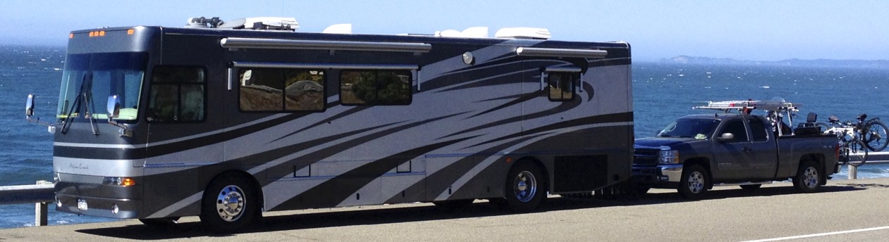
We had quite the busy Tuesday… We took our little dog ‘Coach’ and jumped into the Silverado for a loong drive around the Santa Fe, NM area.
Follow along:
We headed north through Santa Fe from our spot at the Elks Lodge on Old Pecos Trail and got on Bishops Lodge Rd (590) which was a nice scenic drive until it joined US-285 after the town of Tesuque. This very scenic route gave us a little flavor of the area. Nice 🙂
Then we took US-285 to Espanola (#1 on the map below) where we stopped for a quick breakfast at McDonalds. Then we got on Hwy 30 and headed southwest again until we saw signs for Puye Cliff Dwellings.

Puye Cliffs (← link here) was home to 1,500 Pueblo Indians who lived, farmed and hunted game there from the 900s to 1580 A.D. Puye Cliffs’ inhabitants then moved into the Rio Grande River valley. They became the ancestors of today’s Santa Clara people, who now live at Santa Clara Pueblo, 10 miles east of Puye.
We stopped inside the Welcome Center along Hwy 30 which served double-duty as a gas station and convenience store to ask how much and how far. It’s free to drive up to the dwellings; tours are available for a fee upon arrival; and the distance was about 7 miles…

we drove through the entrance and headed west…

until we got to a scenic overlook…

Here’s the informational placard I’m looking at in the pic above:


From the scenic viewpoint we could see a forest fire in the distance.

We drove on to the Cliff Dwellings and parked in front of the visitors center.

Once inside the visitor center…

we viewed the tour prices…

and took into consideration the length of time and distance one of the tours would require; we decided we couldn’t leave little Coach in the pickup for that long.
Notice the “Tour Pass Required” sign:

We read the literature available in the visitor center to gain some knowledge about this neat place. There was no film or documentary available to watch, as in many visitor centers. We went behind the center and took pictures.


You can see some folks on one of the tours climbing the ladder (below).

After leaving the Cliff Dwellings we got back on Hwy 30 south and stopped at White Rock where we saw a huge parking lot and visitor center for Bandelier National Monument (← link here), (#2 on map below).
A nice lady inside the visitor center told us that shuttles are required to get to the Bandelier National Monument and no dogs are allowed 🙁 but we could drive along scenic Hwy 4 right next to the monument and go into Los Alamos from 501 on the west side. Click HERE to see google images of Bandlier National Monument.

We drove along Hwy 4 to the campground at the entrance to the monument.

We toured the campground for future reference. Here are the rates and a map:


Since we couldn’t take little Coach to the monument in a shuttle, we continued west on Hwy 4 and passed our turn for Los Alamos to see the Valle Grande Scenic Viewpoint (#3 on map below) which was prominently marked on the literature and map we got at the visitors center.
It was a steep and windy road and we’re not sure it was worth the extra miles drive just to turn around again, but hey – we were here now.

Click HERE and HERE for more information on Valle Grande aka Valles Caldera.


After checking out the reportedly ‘largest extinct volcanic crater’ from the viewpoint, we turned around and headed to Los Alamos.

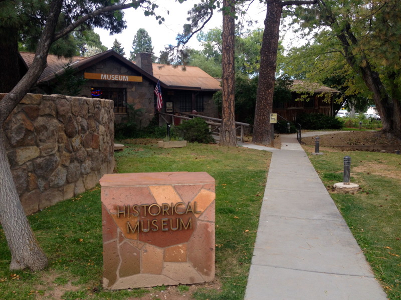
In Los Alamos, (#4 on my map above) we stopped first at the Historical Museum. (Don’t forget to click on the links).

Built as an infirmary in 1918 and later used as the guest cottage for Los Alamos Ranch School, the museum is in the oldest continually occupied structure in town. During the Manhattan Project (1943 to 1947), the cottage continued to serve as guest quarters.

After an interesting and informative tour of the Historical Museum we took a walking tour of the nearby sites with little Coach in tow.
Follow along on our walking tour:


More pics of Fuller Lodge:


More pics of the ruins mentioned in the placard above:


After our energizing walking tour, we drove over to the Bradbury Science Museum.

This was a really neat museum! We could spend hours here, but it was getting late in the day. We watched a very informative documentary film in the theater about the history of Los Alamos.


We left Los Alamos around 4:30 PM and headed back to Santa Fe. When we got close to the Elks Lodge, we remembered that the town of Madrid was nearby. Madrid was made famous by the movie Wild Hogs starring Tim Allen, John Travolta, and others. Click HERE for a link to an informational website provided by several businesses in town. We have to stop by Madrid since we’re this close, right!?!
We plugged Madrid (#5 on map below) into our iPhone GPS and drove the ~25 miles from our camping spot at Elks Lodge 460.


We stopped at the Mine Shaft Tavern (←link) known as one of the ‘last great roadhouses’.


We enjoyed a nice dinner while looking down on the main street of Madrid.


Giant chile pepper archway behind the tavern.

After an enjoyable dinner and an already long day, we stopped in front of Maggie’s Diner for a couple more pics before the sun went down. We found out from the website that the diner was built for the movie and is now a gift shop. Unfortunately it was closed for the day 🙁


Hope you enjoyed the tour today.
We’ll probably start heading towards Lake Powell today, the intermediate destination we have in mind is Farmington, NM. Check back to see if we made it… 🙂